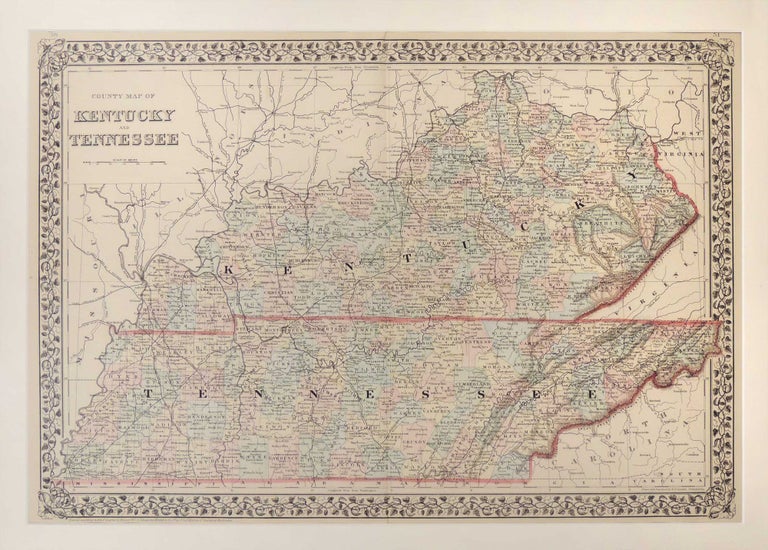
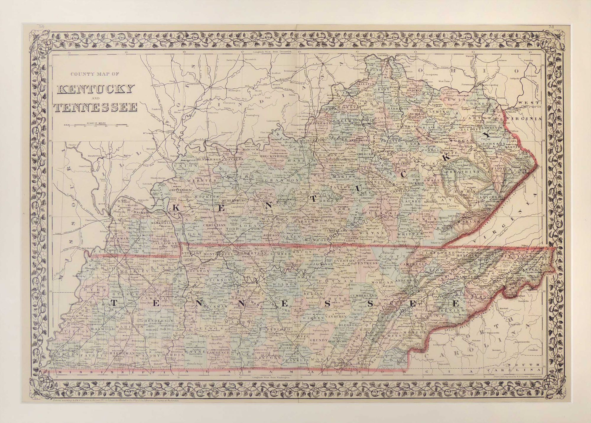
Map of Kentucky and Tennessee
Philadelphia: 1880. A leaf from Mitchell's New General Atlas, Containing Maps of the Various Counties of the World, Plans of Cities, Etc., Embraced in Ninety-three quarto maps. Hand colored. Relief shown by hachures. Shows settlements, railroads, rivers, etc. Prime meridians: Greenwich and Washington, DC. Map measures 38.1 x 55 cm. or approximately 15 x 21.65 inches. Archivally matted. #53554. Near Fine.
Item #27287
Price: $235.00
See all items in
Maps
See all items by Samuel Augustus Mitchell