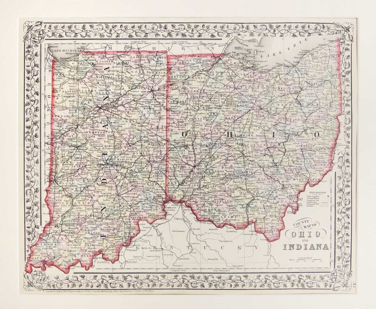
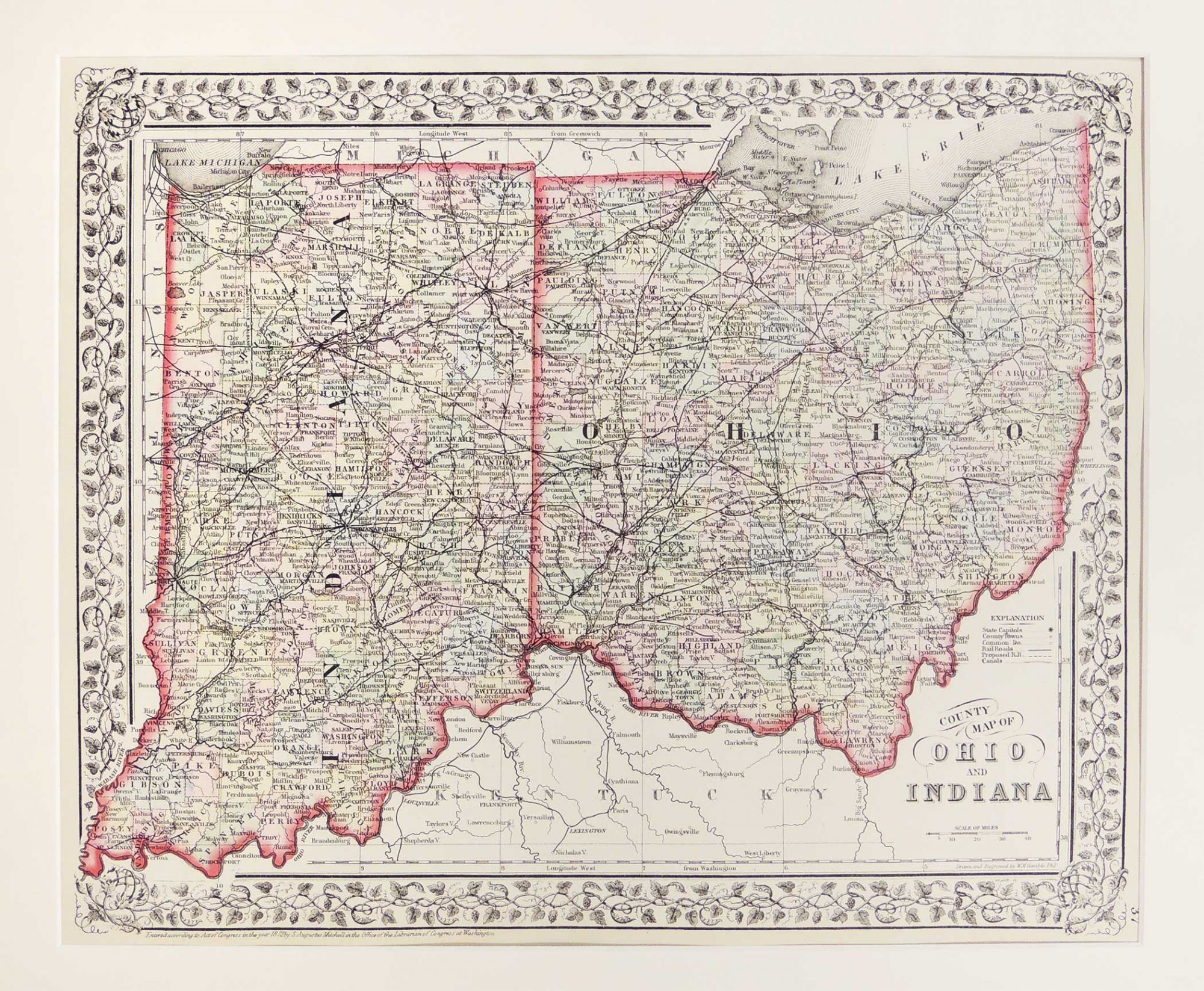
County Map of Ohio and Indiana
Philadelphia: 1860. A leaf from Mitchell's New General Atlas, Containing Maps of the Various Counties of the World, Plans of Cities, Etc. Embraced in Forty-Seven Quarto Maps, Forming a Series of Sevety-Six Maps and Plans, Together with Valuable Statistical Tables. Hand colored, shows settlements, railroads, canals, etc. Prime meridians: Greenwich and Washington, DC. Map measures 33 x 40 cm. or approximately 12.99 x 31.50 inches. Archivally matted. #54236. Near Fine.
Item #27285
Price: $85.00
See all items in
Maps
See all items by Samuel Augustus Mitchell