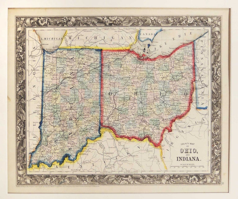
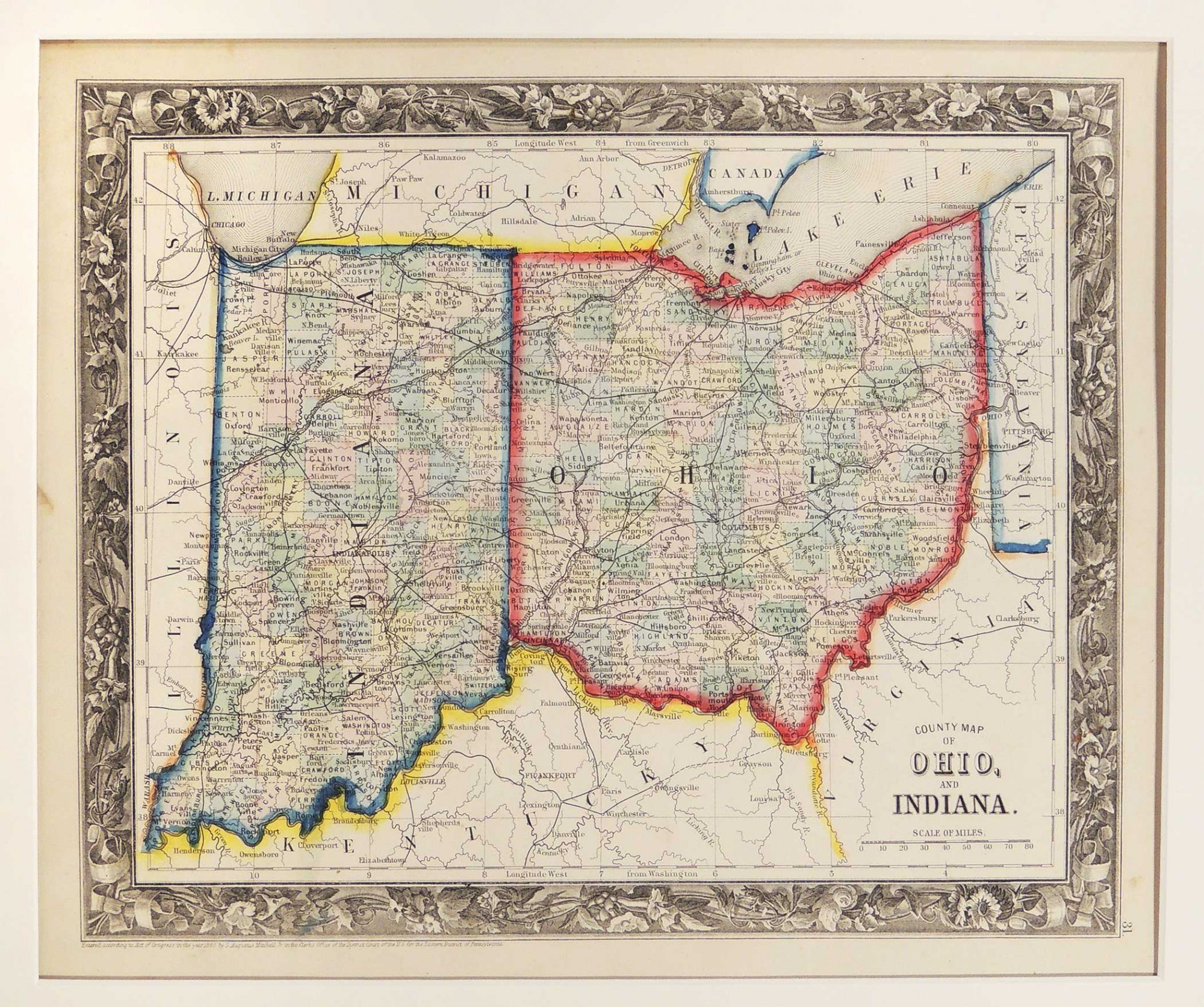
County Map of Ohio and Indiana
Philadelphia: 1860. A leaf from Mitchell's New General Atlas, Containing Maps of the Various Counties of the World, Plans of Cities, Etc. Embraced in Forty-Seven Quarto Maps, Forming a Series of Sevety-Six Maps and Plans, Together with Valuable Statistical Tables. Full color map by county. Prime meridians are Greenwich and Washington, DC. Map measures 28 x 34 cm. or approximately 11.02 x 13.39 inches. Archivally matted. #53620. Near Fine.
Item #27282
Price: $185.00
See all items in
Maps
See all items by Samuel Augustus Mitchell