Colton's Map of Baltimore, Maryland
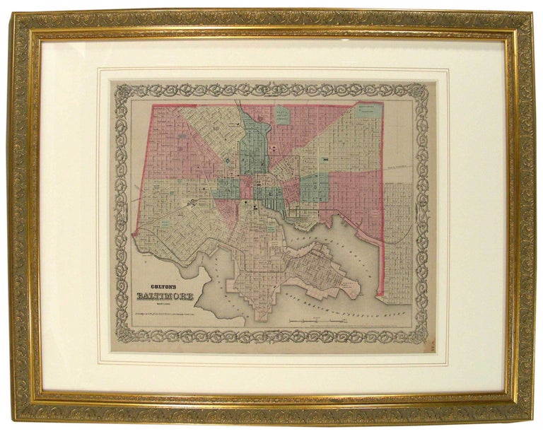
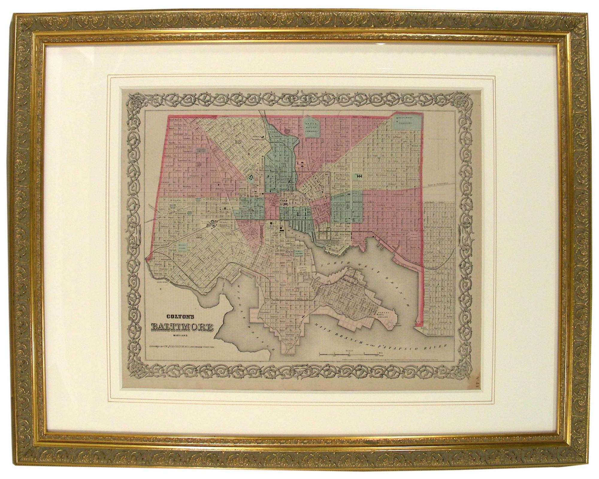
New York: G.W. and C.B. Colton & Co., 1855. Entered according to Act of Congress in the year 1855 by J.H. Colton & Co in the Clerks Office of the District Court of the United States for the Southern District of New York. No.43." This map is from one of many variations of reprints from Colton's original "General Atlas," that was printed from 1857 through 1888. Joseph Hutchins Colton (1800-1893) founded the family publishing house in 1831, which remained a major American atlas publisher throughout the 19th century. G.W. (George Woolworth) Colton (1827-1901), Along with brother, C.B. (Charles B.) Colton (1832-1916), took control of the company around 1865. It is a steel engraving. Baltimore is divided into hand colored numbered sections surrounded by the renowned Colton decorative outside border. Displays street names, cemeteries, railroad tracks and stations and major buildings including Fort McHenry., featuring the North West, Main and Middle branches of the Patapsco River. The map title is located in the lower left corner and the one mile scale is located just left of the lower right. Simple compass rose is located in upper right corner. The reverse page contains detailed historical and 1855-1860 census statistics on a variety of subjects regarding the state of Delaware. Minor foxing outside border in margin. Size of Map: 33.5cm X 41cm (13 1/4" X 16") Framed. #45461. Near Fine.
Item #27077
Price: $750.00