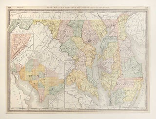
Map of Delaware, Maryland and Washington, DC
1887. A leaf from Rand, McNally & Co.'s New Indexed Atlas of the World Containing Large Scale Maps of Every Country and Civil Divisions Upon the Face of the Globe. This double page map presents Delaware, Maryland and Washington, DC with lithographic color differentiating the various geographical regions within. Major cities, towns, rivers and geographic terrain are identified. Map measures 34 x 49.4 cm. or approximately 13 3/8 x 19 1/2 inches. Archivally matted. #50796. Near Fine. More